Sunday, 9 June 2013

Glyder Fawr & Glyder Fach


Start (OS Grid): Idwal Cottage (SH 649 603)
Route: Llyn Idwal / Idwal Slabs / Devil's Kitchen / Llyn y Cwn / Glyder Fawr / Castle of the Winds  / Glyder Fach / The Cantilever / Bwlch Tryfan / Llyn Bochlwyd
Map: Explorer OL17

Distance: 10.9km (6.8miles)
Time Moving: 04:04:27
Time Stop: 03:30:36
Average Moving Speed: 2.7km/h
Maximum Elevation: 1001m

Who With: Jim, Jane, Vicki, Ian
Conditions: Sunny / Warm
Refreshments: None
Hazards: Steep drops close to path / loose scree / some minor scrambling
Difficulty: Challenging


Start at Idwal / Ogwen Cottage car park. A new visitor centre is under construction and so there are just portaloos and a van serving drinks currently but parking is free for now!

The initial path leading towards Llyn Idwal is well constructed. We feel strong!


Confirmation we are in the correct mountain range in Snowdonia.


Beautiful view.....Tryfan!


We soon arrive at Llyn Idwal. 
Our route passes close to the Devil's Kitchen (Twll Du) seen here just to the right above my head. 
Steam rising from this crack in the rock is thought to have sinister origins 
(it's actually just moist air condensing into clouds)!


Taking the path to the left of the lake brings you to the Idwal slabs
and more than likely some rock climbers.


The view back across Llyn Idwal towards the Carneddau range.
Amazing views in these conditions.


The first slightly tricky part,
crossing a stream coming from the upper cliff of Glyder Fawr.


The path becomes rougher as you approach the Devil's kitchen.


The views open up further as we get higher with Llyn Ogwen now coming into view.


Did I really come with these guys or have some yanks gatecrashed!


Getting steep and rocky now! Hands required in a few places.


Seriously, we just came up there?!
Just skirting round the Devil's Kitchen and about to loose the magnificent view.


The ground levels out and soon we reach Llyn y Cwn and our lunch stop!


Time for a swift half and some sunbathing!


The motley crew.


A steep scree slope leads the way to Glyder Fawr.


Looking back across our lunch stop towards Y Garn - a peak for another day!


Cumulonimbus = cow patterned Carneddau!


As it flattens out views open up towards Llanberis.


Snowdon in the 'V'


Must reach the very pinnacle of Glyder Fawr!


Still couldn't get the GPS to reach 1001m.....
must be old school ordnance survey as it got to 999m
(if this comment makes no sense it's ok!)


I can see the sea - the angle sey!

Hello everybody!


On the way from Glyder Fawr to Glyder Fach we see Y Gribin ridge - tempting to descend but weather is too good to cut today short!


Looking into the Nameless Cwm you can just see Llyn Idwal sticking out near to where we started.


Nearing Glyder Fach the massive shattered ankle breaking boulders make a return!


Heaven and hell


No this isn't the summit it's over there!


Hey look at me, not on the summit!


Castle of the Winds (Castell y Gwynt) is reached before the summit with Snowdon looming behind.


Spiderman has to make it to the top again!
This time Glyder Fach at 994m proves much more difficult with its huge slabs of rock.


Next we reach the famous Cantilever stone.....


.....and all climb on for the obligatory shot!


Heading east from the top we get a view of 
Llyn Bochlwyd or 'Lake Australia'
(because it's shaped like Australia - duh!)


Another fine view of Tryfan this time showing the Far South Peak too.


Not fancying bristly ridge today we continue to head down towards the Miner's Track with a view of Llyn Caseg-fraith.


Turning left before the lake the descent is quite rough and loose.


After climbing again we reach the wall at Bwlch Tryfan.


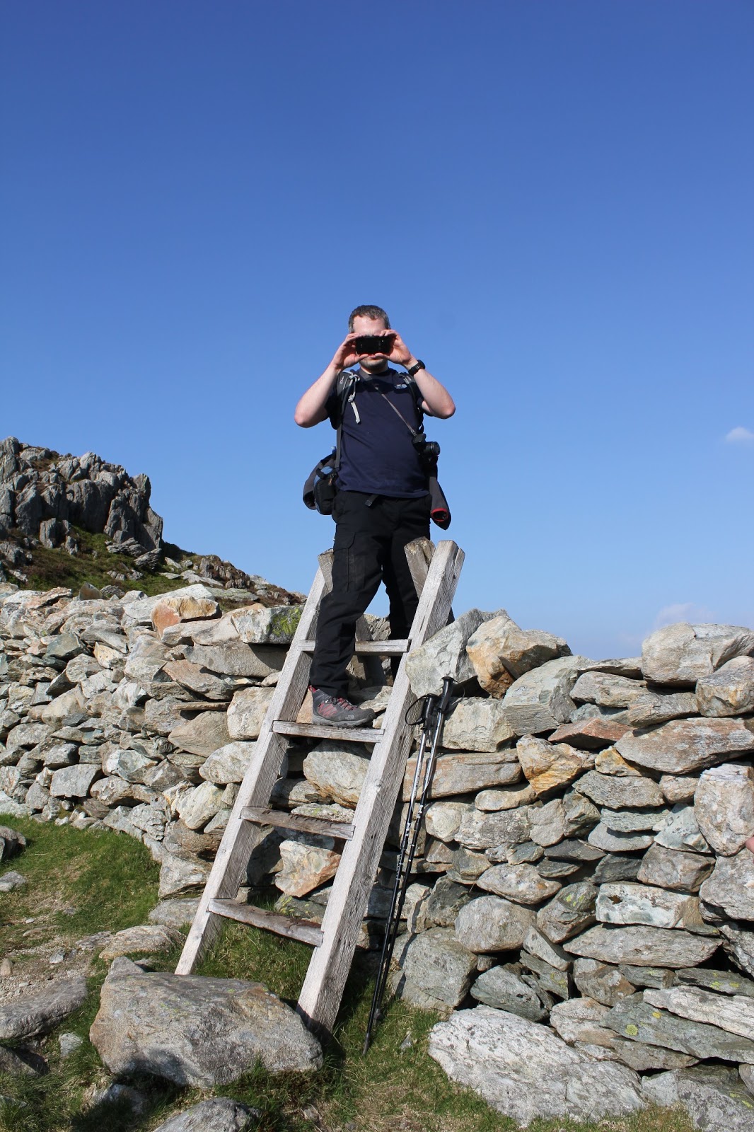
Photo's with style


The final lake of the day in the evening sunshine -
Lake Austraila - shame but no BBQs in sight!


Looking back towards the cliffs of Glyder Fach.


On the final descent back towards Llyn Ogwen -phew!


What a day! An epic walk in Snowdonia National Park with amazing weather and views! Company wasn't too bad either!


Tuesday, 21 May 2013

Ben Nevis


Start (OS Grid): Glen Nevis Visitor Centre (NN 122 730)
Route: Pony Track / Tourist Route / Mountain Path
Map: Explorer 392
Distance: 16.7km (10.4miles)
Time Moving: 05:12:19
Time Stop: 02:30:44
Average Moving Speed: 3.2km/h
Maximum Elevation: 1344m

Who With: Jim
Conditions: Cloudy, dry, lying snow from 1100m

Refreshments: Ben Nevis Inn near start / finish
Hazards: Poor visibility and lying snow on summit plateau
Difficulty: Challenging


Starting at the Glen Nevis visitor centre the route is obvious.


Crossing the suspension bridge over the River Nevis towards Achintee House and the Ben Nevis Inn. Bouncy, bouncy!


The first section of path is easy.....but not for long!


As the ground gets rougher a steep path joins from the youth hostel.


The path is badly eroded in places as over 100,000 people per year climb Ben Nevis.


Nevis Forest within Glen Nevis


First view of the Red Burn with a snow patch close to where we cross!


The first view of  Lochan Meall an t'Suidhe or halfway lochan.
This isn't actually half way though!

The short section passing the lochan is the only place where the path could be described as easy along the whole route.
The sun was trying to come out....we were praying it wouldn't!


Me (doing a man leg) and Jim having our lunch stop.
This photo was taken by two Japanese girls...they didn't make it (to the top I mean!)

Loch Linnhe starts to come into view as we ascend further.
The path we have just come up can be seen on the opposite hill.


Crossing the Red Burn. This is actually half way!
It's not difficult to cross at all...so don't be scared!

Looking down the Red Burn whilst crossing it. See it's not that bad!

The views just keep getting better. Behind Meall an t-Suidhe you can see Loch Eil.

Jim you're spoiling that view!

Starting up the zig zags more distant peaks come into view.
Some boffin could probably name them all, that's not me.

Looking across Glen Nevis towards The Mamores. I like that name!

Into the cloud we go at about 1050m.

Not long after the snow patches start!

Feels strange with your head in the clouds!
The peaks have disappeared but the Lochs are still there!

Approaching the summit plateau and the snow is starting to build up!
Still half a mile slog across the plateau to the summit...you're not there yet but at least the zig zags are over!

OK, now everything is white! Who knows where the mountain ends and the sky begins! Best to follow the Cairns in these conditions which are 6 feet tall when there is no snow!

Just need some skis now!

A glimmer of hope of getting a view from the summit soon disappeared. Apparently the summit is cloud free for only one in every ten days.

When you see three cairns turn left. This is a general direction, you may have to use a compass if you cannot see the next cairn!

This is because you will be passing very close to some of the highest cliffs in the UK. This is the top of Gardyloo Gully and footprints in the snow show some people had walked across the overhanging snow cornices oblivious to the 700m drop below them!

We made it to the top of Ben Nevis!

Ben Nevis is 1344m (4409ft).
Looks like it has grown a few meters according to my GPS!

It was a quiet day on the summit. We saw three other people.....all men on their own!

For a short period of time this must have been the highest beer in the UK!

With the Pony Track it's the same way back down to your welcoming party and the pub!

A well deserved ale at the Ben Nevis Inn after a hard days mountain walking is obligatory!